Here I try to put ideas together in ways that perhaps are not immediately apparent. After all everything and every cause and effect is ultimately related to every other. Finding these hyper-dimensional ties between things and pointing them out is my pleasure, and indulgence here.
Wednesday, August 31, 2005
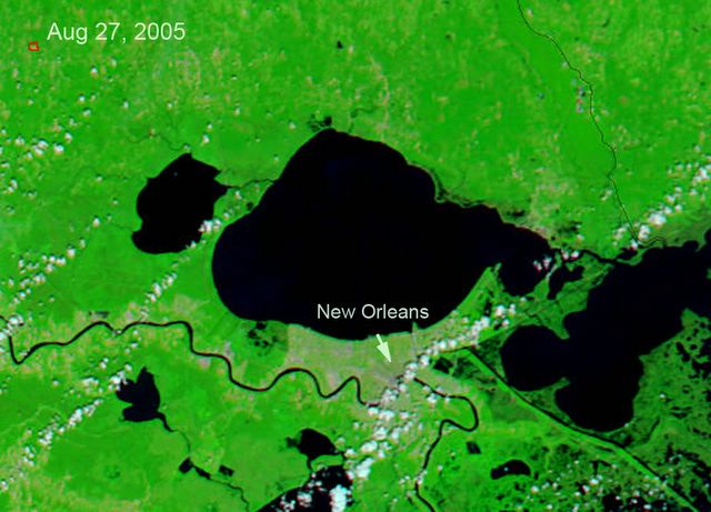
Image Enhancement of New Orleans Flood Areas
I took the before / after images of New Orleans and Lake Pontchartrain blanked the clouds, and enhanced the difference which gives a good estimate of the flooded land around the lake, including New Orleans.
The satellite images originated on; http://earthobservatory.nasa.gov/
Difference Blue and Red are flooded areas, including New Orleans at the point of the arrow. Before ... http://earthobservatory.nasa.gov/


No comments:
Post a Comment