Thursday, September 29, 2005
Something Interesting For Google Earth fans
If you take a look at at the Google images of Wright-Patterson AFB where the Air Musuem is you can find a seeing eye chart for satalite photographs, vertical and horizontal bars for resolution and a gray scale chart. Specifically at N38 deg 36.3", West 84 deg 07.3" I'm guessing that the little arrows on the chart mark 1 meter resolution, also a guess that the Google Earth image is about 6 or 8 meter res. Interesting that the chart seems to go all the up to centimeter resolution levels. I ca'nt really tell if it goes beyond that.
Friday, September 23, 2005
Stargate SG1
There once was Cornel O'Neil,
Who would step through the Stargate with zeal,
Goa'ould he would find,
and then kick their behinds,
Till a General's stars did he wield.
(Stargate Limerick)
Who would step through the Stargate with zeal,
Goa'ould he would find,
and then kick their behinds,
Till a General's stars did he wield.
(Stargate Limerick)
Sunday, September 11, 2005
Theres a little black spot on the Sun today ...
The little Sun spot that's been generating the X-class flares is much quieter today. It might stay that way and the current solar storm will drift quietly away. Wouldn't want my cable TV to go out :)
It only has to be quiet for a couple of days and we will have dodged a big satellite killing bullet.
It only has to be quiet for a couple of days and we will have dodged a big satellite killing bullet.
Saturday, September 10, 2005
Theres a little black spot on the Sun today ...
Yes there is. I set up a binocular projector (one lense covered) to see it for myself. Very interesting. If the sun seems a bit brighter and harsher today that's because it is.
Possible cable TV and power grid outages next week. This spots been throwing X class flares for at least a week. See
Space Weather
http://www.google.com/search?sourceid=navclient-ff&ie=UTF-8&q=Space%20weather
Possible cable TV and power grid outages next week. This spots been throwing X class flares for at least a week. See
Space Weather
http://www.google.com/search?sourceid=navclient-ff&ie=UTF-8&q=Space%20weather
Wednesday, August 31, 2005
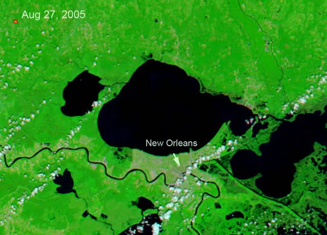
Flood Enhancement Over City Image
This image is the below color flood enhancements superimposed on a Google-Earth image of New Orleans. The color shows some of the flooding as of 8/30. The flooding is probally more extensive by this time. 


Image Enhancement of New Orleans Flood Areas
I took the before / after images of New Orleans and Lake Pontchartrain blanked the clouds, and enhanced the difference which gives a good estimate of the flooded land around the lake, including New Orleans.
The satellite images originated on;
http://earthobservatory.nasa.gov/
Difference Blue and Red are flooded areas, including New Orleans at the point of the arrow.

Before ...
http://earthobservatory.nasa.gov/

After ...

The satellite images originated on;
http://earthobservatory.nasa.gov/
Difference Blue and Red are flooded areas, including New Orleans at the point of the arrow.

Before ...
http://earthobservatory.nasa.gov/
After ...

Wednesday, August 17, 2005
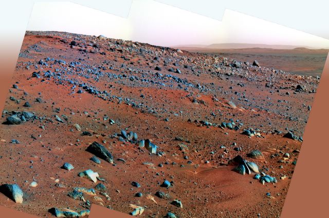
Mer-A Spirit, July color view from the hill ...
This is a recent six image pan I just stitched together from the side of the hill overlooking the crater plain. Spirit has a good view. The original is about 2900 pixels across. Colors are shifted to the red a bit because the red filter was in the near infra-red. To human eyes the whole scene would appear a bit more tan and the rocks a flatter grey, the pinkish tinge would be gone from the sky replaced with the color of sand. Desolate and dusty.

Sunday, August 14, 2005
Sunset from Gusev Crater
The spirit rover (mer-a) recently took this color sunset shot from the hill it's been climbing looking out across the crater floor. This image was processed to merge the sun into a single image from the red green blue images.


Saturday, August 13, 2005
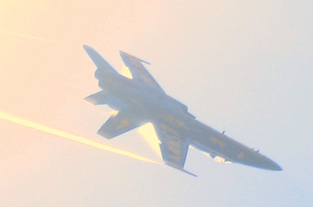
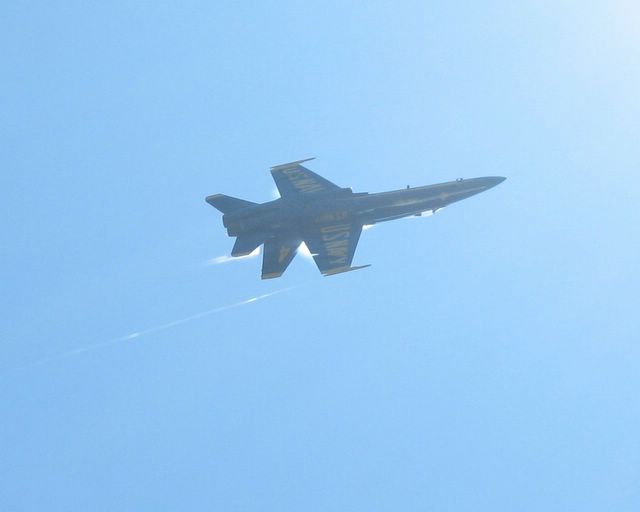
Five F18s go head to head over Lake Washington
Just about as many head to head F18s in one image I've ever seen. This is the 2005 Seattle Sea-fair Blue Angles last Sunday.


Tuesday, August 02, 2005

Sunday, July 31, 2005


Thursday, July 28, 2005
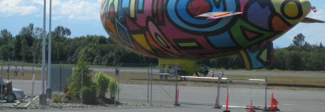
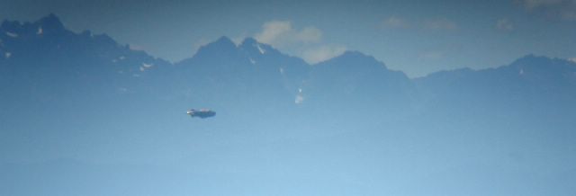
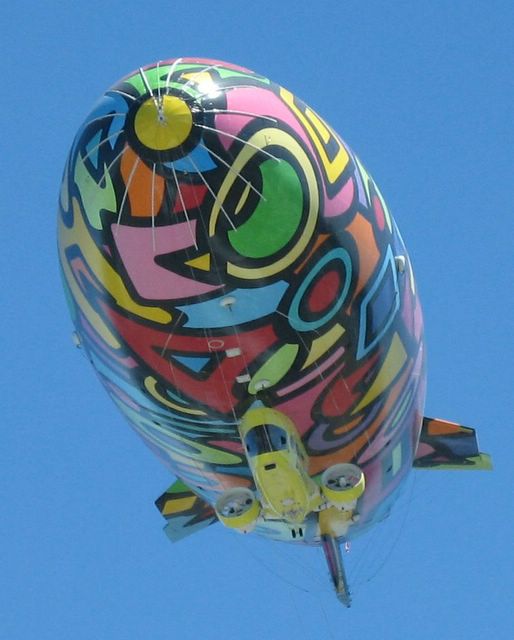
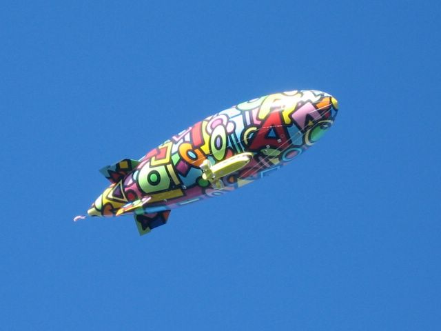
Psychedelic Blimp In Seattle
Spotted the "psychedelic blimp" this past week. Saturday afternoon it was dropping in to Pain field (Everett), Sunday afternoon, we saw it over Pacific raceways (7-24) - I guess moonraker was in the air earlier in the day and got closer to it, and yesterday, 7-27 it made at least six passes over out house while it circled the Greenwood parade (A prelude to Seattles Seafair). This is the first picture I took of about 50.

Here is a bit of a close up, notice she is towing old glory.

And this is the paint scheme on the other side.

Just a crop of the gondola.

Here is a bit of a close up, notice she is towing old glory.

And this is the paint scheme on the other side.

Just a crop of the gondola.

Tuesday, July 19, 2005
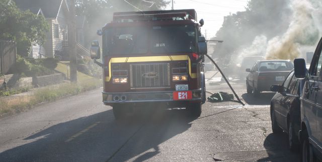
Car Fire in Seattle (Tuesday, 7/19/2005)
Came upon a car fire directly in the way of getting home today on about 80th and Linden.

Subscribe to:
Posts (Atom)